Most travelers planning a gorilla trekking Uganda expedition make a critical mistake: they assume all permits offer the same physical experience. You might book a permit for Bwindi Impenetrable National Park, only to find yourself facing a 7-hour vertical scramble that your knees weren’t prepared for. Conversely, you might choose Mgahinga thinking it’s “easier,” only to realize you’re trekking at much higher altitudes where the air is significantly thinner.
Selecting the wrong sector doesn’t just tire you out, it can compromise the entire experience. This guide breaks down the granular terrain data and route allocation logic to ensure your uganda gorilla trekking adventure matches your physical capabilities and expectations.
The Core Divide: Bwindi’s Four Sectors vs. Mgahinga’s Single Peak
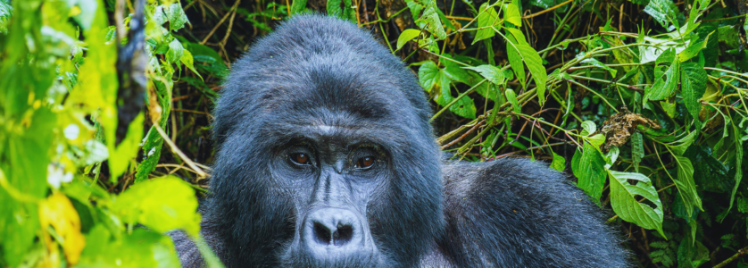
In Uganda, mountain gorillas are found in two distinct locations: Bwindi Impenetrable National Park and Mgahinga Gorilla National Park. While they are geographically close, the trekking mechanics differ wildly.
1. Bwindi Impenetrable National Park: The Jungle Labyrinth
Bwindi is subdivided into four distinct trekking sectors: Buhoma, Ruhija, Rushaga, and Nkuringo. Route allocation here is determined by the specific gorilla family you are assigned on the morning of the trek.
- Buhoma (North): Generally offers lower altitude treks. The terrain is undulating but less punishing than the south.
- Ruhija (East): The highest point in Bwindi. You start on a ridge and descend into deep valleys, meaning the hardest part is the climb back out at the end of the day.
- Rushaga & Nkuringo (South): Known for steep ridges and breathtaking vistas. Nkuringo, in particular, is widely considered the most physically demanding sector due to its sheer 600-meter vertical ascents.
Unlike Bwindi’s dense, tangled undergrowth, Mgahinga is part of the Virunga Massif. Gorilla trekking in Uganda via Mgahinga involves traversing the slopes of three extinct volcanoes: Mt. Gahinga, Mt. Muhabura, and Mt. Sabinyo. The terrain is more open, characterized by bamboo forests and volcanic rock, but the altitude is significantly higher, often exceeding 3,000 meters.
Terrain & Elevation: A Data-Driven Comparison
To help you mitigate risk and choose the right path, we’ve aggregated GPS terrain data across the primary trekking zones.
Trekking Complexity Matrix
| Sector | Average Elevation | Terrain Type | Physical Demand | Best For |
| Buhoma | 1,100m – 1,600m | Ancient rainforest, moderate slopes | Moderate | Seniors / Beginners |
| Ruhija | 2,100m – 2,500m | Deep valleys, thick ferns | High | Birders & Photographers |
| Rushaga | 1,700m – 2,100m | Sharp ridges, multiple valleys | High | Habituation Seekers |
| Nkuringo | 2,100m – 2,600m | Vertical ridges, rocky paths | Very High | Fitness Enthusiasts |
| Mgahinga | 2,200m – 3,400m | Bamboo forest, volcanic ash | Moderate-High | High-altitude lovers |
Route Allocation: How Your Permit Decides Your Day
When you purchase a permit for gorilla trekking Uganda, you aren’t just buying time with primates; you are being allocated a specific “sector.” Here is how the logistics work on the ground:
- The Morning Briefing: At 7:30 AM, rangers assess the group. If you have physical limitations, this is the moment to speak up. Rangers often allocate “closer” families to those who may struggle with a 6-hour hike.
- The Tracker’s Lead: Advance trackers head into the forest at dawn. They find where the gorillas nested the previous night and follow their trail. Your route is entirely dependent on where the gorillas decided to sleep.
- The “Buhoma Advantage”: Because Buhoma was the first sector opened, its trails are generally more “established,” though “established” in Bwindi still means hacking through vines with a machete.
Seasonal Road Viability & Logistics
Terrain analysis isn’t just about the hike; it’s about getting to the trailhead.
- The Rainy Season (March-May & October-November): Bwindi’s red clay “murram” roads become notoriously slippery. We recommend 4×4 Land Cruisers exclusively during these months.
- The Mgahinga Factor: Mgahinga is often easier to access from Kigali (Rwanda) than from Entebbe, involving a shorter drive time across the border, which can save your legs for the actual trek.
Strategic Takeaways for Your Safari
- Book Nkuringo if you want the view: The view of the Virunga volcanoes from the Nkuringo ridge is the best in Uganda, but your calves will pay the price.
- Choose Mgahinga for “Open” Sightlines: The bamboo forests of Mgahinga offer clearer lines of sight for photography compared to the “impenetrable” canopy of Bwindi.
- Hire a Porter: Regardless of the sector, a porter is the best $20 you will spend. They don’t just carry your bag; they provide a physical “push/pull” on steep embankments that can be the difference between finishing the trek and turning back.
Frequently Asked Questions
Which is easier, Bwindi or Mgahinga?
Generally, Bwindi’s Buhoma sector is considered the “easiest” due to lower elevations. Mgahinga is less “tangled” but the high altitude can make breathing difficult for some trekkers.
Can I choose which gorilla family to visit?
You can request a specific family during the morning briefing. While rangers try to accommodate requests based on fitness levels, the final allocation depends on the gorillas’ location and park safety protocols.
What happens if I can’t finish the trek?
In Bwindi, there is a “helicopter” (a stretcher carried by porters) available for an extra fee (approx. $300-$500) to carry exhausted or injured trekkers out of the forest.
How long does a typical trek last?
Treks can last anywhere from 2 to 8 hours. There is no guarantee of time, as mountain gorillas are wild animals and move constantly in search of food.
 >
>